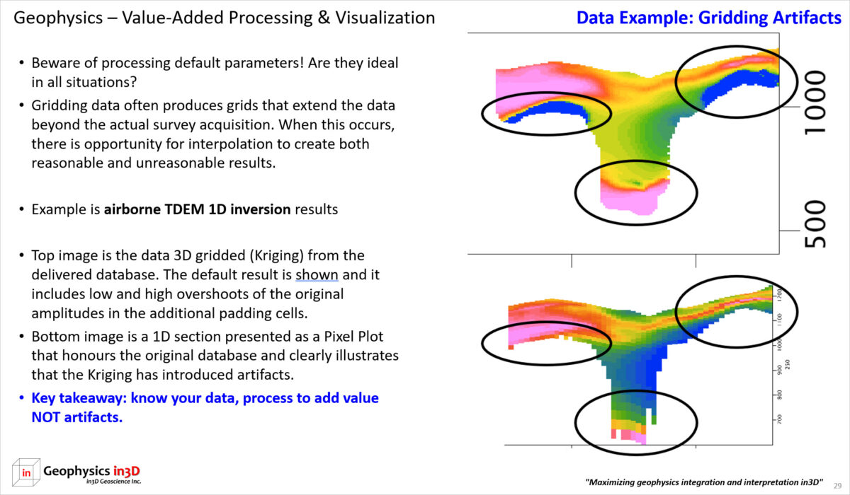
Understanding geophysical data and any associated processing or visualization tools is very important. Beware of default processing parameters! Are they ideal in all situations? Gridding data often produces grids that extend the data beyond the actual survey acquisition. When this occurs, there is opportunity for interpolation to create both reasonable and unreasonable results. The example today is airborne TDEM 1D inversion results.
The top image is the data 3D gridded (Kriging) from the delivered database. The default result is shown and it includes low and high overshoots of the original amplitudes in the additional padding cells. The bottom image is a 1D section presented as a Pixel Plot that honours the original database and clearly illustrates that the Kriging has introduced artifacts.
Key takeaway: know your data, process to add value NOT artifacts.

