Targeting & Drilling
Targeting and drill hole planning are conducted using a combination of 2D and 3D maps. A targeting example could be the use of K-means clustering of magnetic and radiometric data, magnetic and electromagnetic data or geophysics and geochemical data. The example below is magnetic and potassium radiometric data on the right side. An example drill hole section shown on the left.
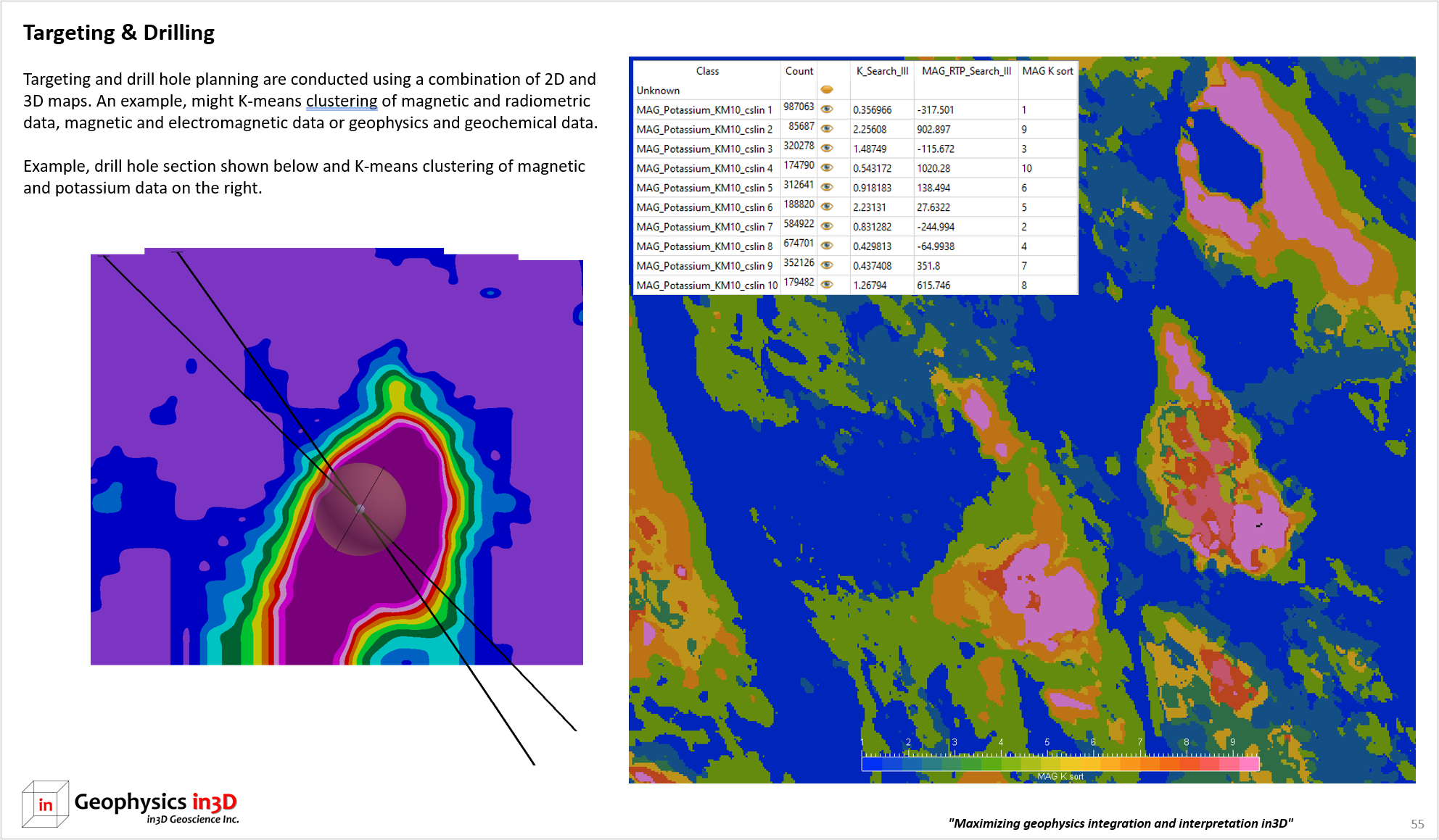
Examples of drill hole planning and K-means clustering.
previous page: Data Interpretation